Zum Inhalt springen
Suchen nach …
Lehre
Bachelor
Master
Forschung
Forschungsprojekte
Publikationen
Lehrstuhl
Team
LearnLab
Fragen & Kontakt
Aktuelles
Fragen & Kontakt
en
Suchen nach …
Navigations-Menü
Fragen & Kontakt
en
Navigations-Menü
Lehre
Bachelor
Master
Forschung
Forschungsprojekte
Publikationen
Lehrstuhl
Team
LearnLab
Fragen & Kontakt
Aktuelles
Master
Sommersemester
Sprich mit deinem Modell, nicht mit einem Bild
Lehre
,
Master
Master
,
SoSe
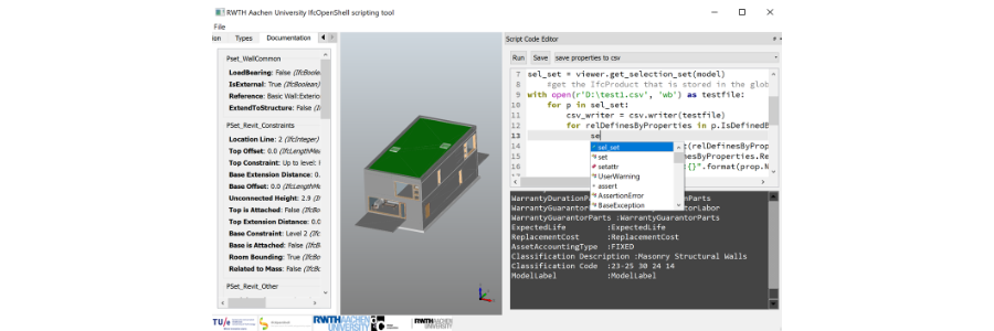
M2 Architekturinformatik
Lehre
,
Master
Forschungsthemen
,
M2
,
SoSe
,
WiSe
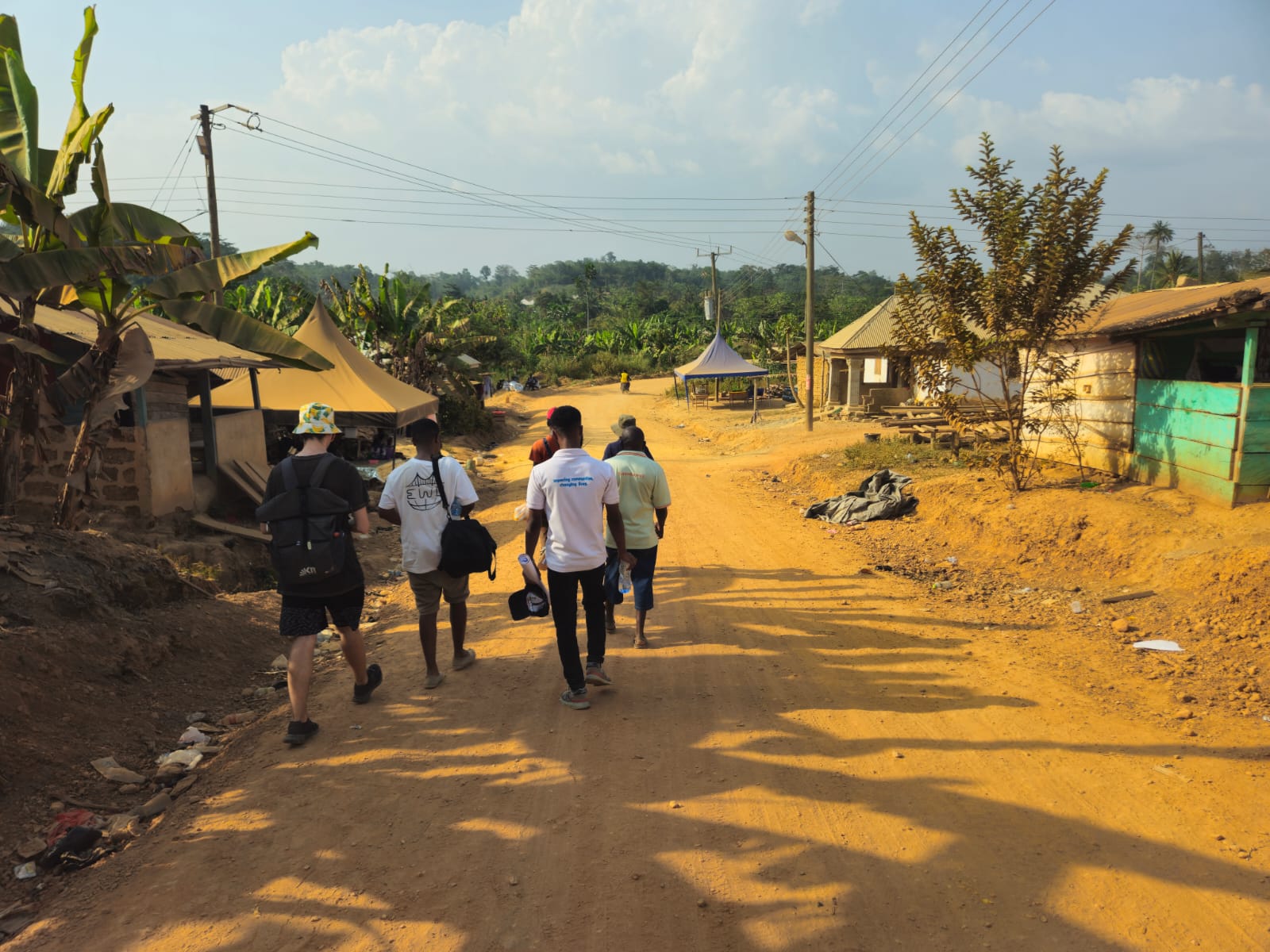
Humanitarian Architecture Studio
Lehre
,
Master
SoSe
,
Stegreif
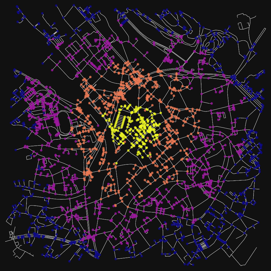
GIS Box Data Factory
Lehre
,
Master
GEO
,
GIS-BOX: Data Factory
,
SoSe
,
TCR
Wissenschaftliche Projekte in der Architekturinformatik
Bachelor
,
Lehre
,
Master
B4
,
BA
,
Forschungsthemen
,
M1
,
M2
,
M3
,
SoSe
,
Thesis
,
WiSe
Wintersemester
M2 Architekturinformatik
Lehre
,
Master
Forschungsthemen
,
M2
,
SoSe
,
WiSe
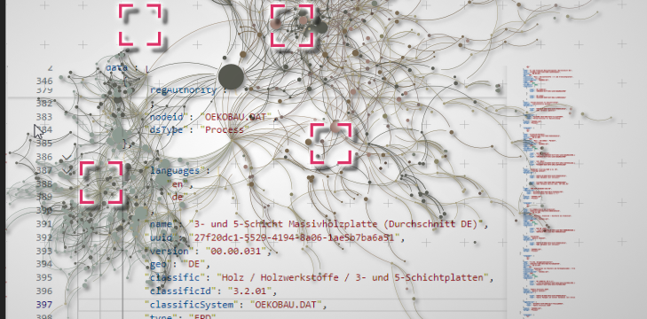
From Bricks to Graphs
Lehre
,
Master
Forschungsfeld
,
WiSe
Informationsarchitektur
Lehre
,
Master
WF Ma
,
WiSe
Wissenschaftliche Projekte in der Architekturinformatik
Bachelor
,
Lehre
,
Master
B4
,
BA
,
Forschungsthemen
,
M1
,
M2
,
M3
,
SoSe
,
Thesis
,
WiSe